Sweden › Stockholm › Huddinge · street
Living on Borevägen.
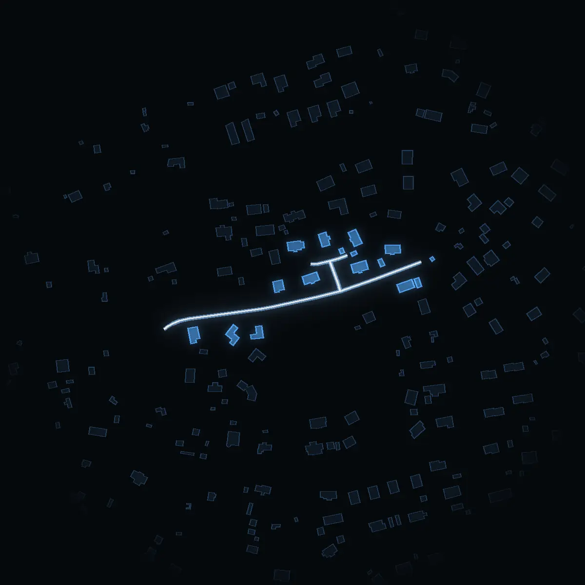
16 buildings stand along its 300 m in Huddinge. The DeSO area it runs through has a mean net income of SEK 404k, and 27% of their dwellings are bostadsrätter. Masmo (tunnelbana) is a 31-minute walk.
The street as OpenStreetMap maps it, its area as SCB counts it. VERA PI shows no street price in Sweden – why, below.
The street
Borevägen, as it stands.
Borevägen is a residential street of about 300 m in Huddinge. OpenStreetMap draws 16 buildings within 25 m of its line.
What the buildings are
OpenStreetMap’s own tags – most Swedish buildings carry no use, so «not tagged» is common and says nothing about the building.
The area around it
Who lives around it.
The street runs through one of SCB’s DeSO areas – Glömsta-Loviseberg. Together they have 1,673 people (2025) with a mean net income of SEK 404k (2024), +7.5% against Huddinge as a whole. These are the areas’ figures, not the street’s: SCB counts people by area, never by street.
How the dwellings are held
Dwellings in the DeSO areas the street runs through, 548 in all.
Against Huddinge
- Mean net incomeSEK 404k here · SEK 376k in Huddinge
- Bostadsrätt27% here · 31% in Huddinge
- Rented7% here · 32% in Huddinge
People 2025, net income 2024 and dwellings by tenure by DeSO area: Source: Statistics Sweden, CC BY 4.0 – an area counts where at least a tenth of the street runs through it.
Getting around
Stations, schools and parks.
The nearest stop is Masmo – 2,500 m on foot, about 31 minutes. 0 school units stand within 500 m of the street.
The nearest stop of each kind
The walk is measured along OpenStreetMap’s streets and paths from the nearest point of the street, at 80 m a minute – never shorter than the straight line, which is shown beside it.
| Kind | Stop | Walk | Time | Straight line |
|---|---|---|---|---|
| Tunnelbana | Masmo | 2,500 m | 31 min | 1,940 m |
| Rail (pendeltåg, Roslagsbanan, Saltsjöbanan) | Flemingsberg | 3,900 m | 49 min | 3,090 m |
| Tram and light rail | none within 6 km | – | – | – |
School units within 500 m
Active units in Skolverket’s register, by distance from the street.
- None within 500 m.
Parks near it
Named parks whose centre lies within 600 m, the largest first.
- None mapped within 600 m.
Stops, streets, paths and parks: © OpenStreetMap contributors, ODbL 1.0. School units: Skolverket’s school-unit register (open data).
Prices – kommun level
The prices of Huddinge.
SCB publishes sale prices by kommun and län – not by street. These are Huddinge’s and Stockholms län’s, never Borevägen’s.
Huddinge’s prices since 1981 · Stockholms län’s bostadsrätter since 2000
Sales of småhus by kommun and of bostadsrätter by län: Source: Statistics Sweden, CC BY 4.0.
Streets nearby
Around the corner.
What VERA PI does not show here, and why
- No individual sale. The price of a house or an owner-occupied flat sits in Lantmäteriet’s register of sale prices (fastighetsprisregistret), which is not open data; SCB publishes it as statistics by kommun and län, and those are the prices shown here. A bostadsrätt is a share in a housing association, not real property – its sales are in no public register at all (the figures for bostadsrätter are SCB’s statistics by län).
- No prices below the kommun: SCB does not publish sale prices by stadsdel or DeSO. The night picture is coloured by the mean net income of each DeSO area, never by a price.
- No property boundary, no address file and no building’s own record: Lantmäteriet’s open property, address and building data (high-value datasets, CC BY 4.0) are released only on an approved application, which VERA PI has not yet made.
- No asking prices and no listings: Hemnet’s and Booli’s terms do not allow their listings to be copied, and VERA PI does not copy them.
- No estimate for a home: without sale-level data an estimate would be a guess, and VERA PI does not publish guesses.
- No price for this street: SCB publishes sale prices by kommun and län only, so the prices shown are Huddinge’s and Stockholms län’s – never the street’s, and no ranking of streets by price.
- The buildings are OpenStreetMap’s outlines within 25 m of the street’s line, not an address register: Lantmäteriet’s address and building data are not yet open to VERA PI. A building on a corner counts for both streets.
Sources and licences
Every figure, and where it comes from.
Every figure is official statistics from Statistics Sweden (SCB) under CC BY 4.0 – «Source: Statistics Sweden» – for the period stated beside it; boundaries from SCB’s DeSO 2025 and Stockholms stad’s Stadskarta (© Stockholms stad, Stadsbyggnadskontoret, CC BY); school units from Skolverket; buildings, stations and parks © OpenStreetMap contributors (ODbL 1.0). Nothing here is a valuation. VERA PI has processed the figures (sums over DeSO areas, changes, ranks). Streets, buildings, stops and parks: © OpenStreetMap contributors (ODbL 1.0) – one street per name and kommun, its parts merged by VERA PI.
- Statistics Sweden (SCB) – Statistikdatabasenfastighetspriser och lagfarter (BO0501), bostadsbestånd (BO0104), hyror (BO0406), befolkning (BE0101), inkomster (HE0110); read 20 October 2026CC BY 4.0 · Source: Statistics Sweden · www.scb.se
- Statistics Sweden – DeSO 2025 (demographic statistical areas)2025_v2Open geodata, CC BY 4.0 · Source: Statistics Sweden · www.scb.se/vara-tjanster/oppna-data/oppna-geodata
- Stockholms stad – Stadskartan: stadsdelar and stadsdelsnämndsområdenStadsbyggnadskontoret, DataportalenCC BY · © Stockholms stad, Stadsbyggnadskontoret · dataportalen.stockholm.se
- Skolverket – the school-unit register and planned educationsopen APIs, read 20 October 2026Open data · Source: Skolverket · www.skolverket.se
- OpenStreetMap – buildings, stations and parksGeofabrik's Sweden extract, 2026-10-20ODbL 1.0 · © OpenStreetMap contributors · www.openstreetmap.org/copyright