Sweden › Stockholm › Sollentuna · street
Living on Blockvägen.
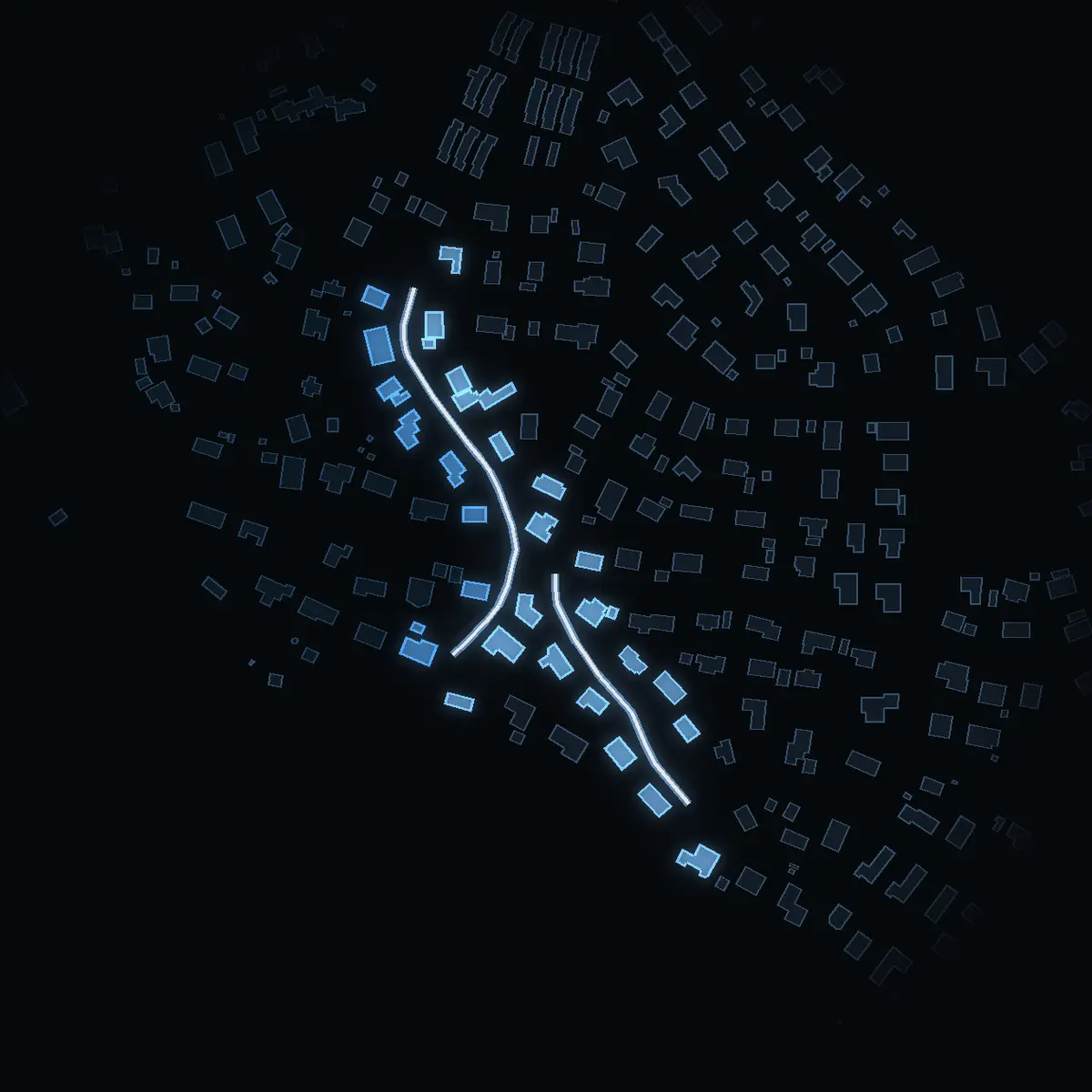
32 buildings stand along its 400 m in Sollentuna. The 2 DeSO areas it runs through have a mean net income of SEK 483k, and 66% of their dwellings are bostadsrätter. Häggvik (rail) is a 27-minute walk.
The street as OpenStreetMap maps it, its area as SCB counts it. VERA PI shows no street price in Sweden – why, below.
The street
Blockvägen, as it stands.
Blockvägen is a residential street of about 400 m in Sollentuna. OpenStreetMap draws 32 buildings within 25 m of its line, typically 2 floors high where the floors are mapped (8 of them).
What the buildings are
OpenStreetMap’s own tags – most Swedish buildings carry no use, so «not tagged» is common and says nothing about the building.
The area around it
Who lives around it.
The street runs through 2 of SCB’s DeSO areas – Landsnora-Kvarnskogen. Together they have 3,506 people (2025) with a mean net income of SEK 483k (2024), +5.2% against Sollentuna as a whole. These are the areas’ figures, not the street’s: SCB counts people by area, never by street.
How the dwellings are held
Dwellings in the DeSO areas the street runs through, 1,660 in all.
Against Sollentuna
- Mean net incomeSEK 483k here · SEK 459k in Sollentuna
- Bostadsrätt66% here · 38% in Sollentuna
- Rented9% here · 28% in Sollentuna
People 2025, net income 2024 and dwellings by tenure by DeSO area: Source: Statistics Sweden, CC BY 4.0 – an area counts where at least a tenth of the street runs through it.
Getting around
Stations, schools and parks.
The nearest stop is Häggvik – 2,170 m on foot, about 27 minutes. 1 school unit stand within 500 m of the street.
The nearest stop of each kind
The walk is measured along OpenStreetMap’s streets and paths from the nearest point of the street, at 80 m a minute – never shorter than the straight line, which is shown beside it.
| Kind | Stop | Walk | Time | Straight line |
|---|---|---|---|---|
| Tunnelbana | Akalla | 5,120 m | 64 min | 3,870 m |
| Rail (pendeltåg, Roslagsbanan, Saltsjöbanan) | Häggvik | 2,170 m | 27 min | 1,770 m |
| Tram and light rail | none within 6 km | – | – | – |
School units within 500 m
Active units in Skolverket’s register, by distance from the street.
- Edsbergsskolan470 m · compulsory
Parks near it
Named parks whose centre lies within 600 m, the largest first.
- Edsbergsparken12.6 ha · 320 m away
Stops, streets, paths and parks: © OpenStreetMap contributors, ODbL 1.0. School units: Skolverket’s school-unit register (open data).
Prices – kommun level
The prices of Sollentuna.
SCB publishes sale prices by kommun and län – not by street. These are Sollentuna’s and Stockholms län’s, never Blockvägen’s.
Sollentuna’s prices since 1981 · Stockholms län’s bostadsrätter since 2000
Sales of småhus by kommun and of bostadsrätter by län: Source: Statistics Sweden, CC BY 4.0.
Streets nearby
Around the corner.
What VERA PI does not show here, and why
- No individual sale. The price of a house or an owner-occupied flat sits in Lantmäteriet’s register of sale prices (fastighetsprisregistret), which is not open data; SCB publishes it as statistics by kommun and län, and those are the prices shown here. A bostadsrätt is a share in a housing association, not real property – its sales are in no public register at all (the figures for bostadsrätter are SCB’s statistics by län).
- No prices below the kommun: SCB does not publish sale prices by stadsdel or DeSO. The night picture is coloured by the mean net income of each DeSO area, never by a price.
- No property boundary, no address file and no building’s own record: Lantmäteriet’s open property, address and building data (high-value datasets, CC BY 4.0) are released only on an approved application, which VERA PI has not yet made.
- No asking prices and no listings: Hemnet’s and Booli’s terms do not allow their listings to be copied, and VERA PI does not copy them.
- No estimate for a home: without sale-level data an estimate would be a guess, and VERA PI does not publish guesses.
- No price for this street: SCB publishes sale prices by kommun and län only, so the prices shown are Sollentuna’s and Stockholms län’s – never the street’s, and no ranking of streets by price.
- The buildings are OpenStreetMap’s outlines within 25 m of the street’s line, not an address register: Lantmäteriet’s address and building data are not yet open to VERA PI. A building on a corner counts for both streets.
Sources and licences
Every figure, and where it comes from.
Every figure is official statistics from Statistics Sweden (SCB) under CC BY 4.0 – «Source: Statistics Sweden» – for the period stated beside it; boundaries from SCB’s DeSO 2025 and Stockholms stad’s Stadskarta (© Stockholms stad, Stadsbyggnadskontoret, CC BY); school units from Skolverket; buildings, stations and parks © OpenStreetMap contributors (ODbL 1.0). Nothing here is a valuation. VERA PI has processed the figures (sums over DeSO areas, changes, ranks). Streets, buildings, stops and parks: © OpenStreetMap contributors (ODbL 1.0) – one street per name and kommun, its parts merged by VERA PI.
- Statistics Sweden (SCB) – Statistikdatabasenfastighetspriser och lagfarter (BO0501), bostadsbestånd (BO0104), hyror (BO0406), befolkning (BE0101), inkomster (HE0110); read 20 October 2026CC BY 4.0 · Source: Statistics Sweden · www.scb.se
- Statistics Sweden – DeSO 2025 (demographic statistical areas)2025_v2Open geodata, CC BY 4.0 · Source: Statistics Sweden · www.scb.se/vara-tjanster/oppna-data/oppna-geodata
- Stockholms stad – Stadskartan: stadsdelar and stadsdelsnämndsområdenStadsbyggnadskontoret, DataportalenCC BY · © Stockholms stad, Stadsbyggnadskontoret · dataportalen.stockholm.se
- Skolverket – the school-unit register and planned educationsopen APIs, read 20 October 2026Open data · Source: Skolverket · www.skolverket.se
- OpenStreetMap – buildings, stations and parksGeofabrik's Sweden extract, 2026-10-20ODbL 1.0 · © OpenStreetMap contributors · www.openstreetmap.org/copyright