Property
Intelligence
Kommuner SV
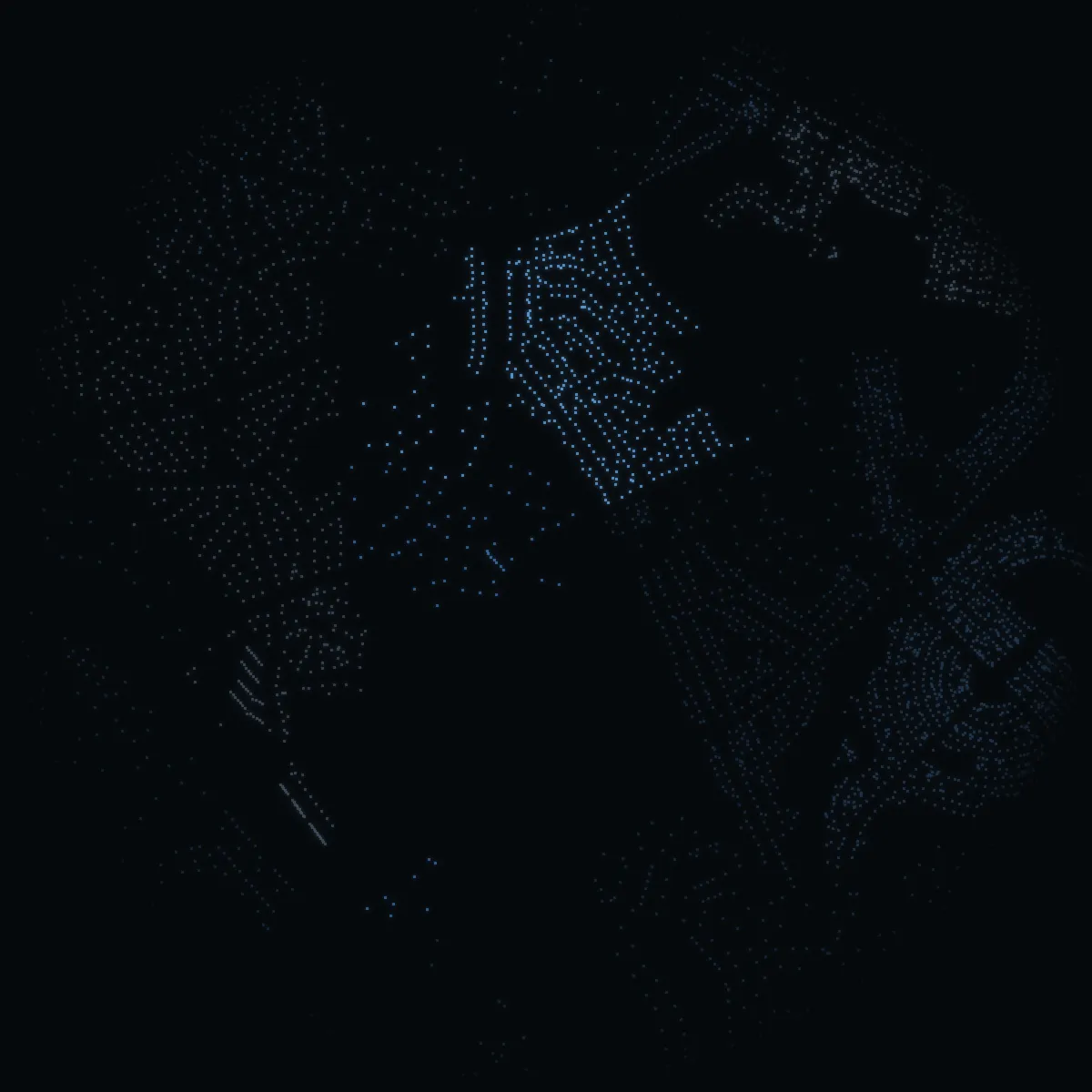
Svedmyra at night – every building a point of light, coloured by its area’s mean net income
Mean net income of the area
SEK 233kSEK 516kSEK 1,143k+
Every point is a building (OpenStreetMap); the colour is the mean net income of its DeSO area in 2024 (SCB) – never a price, never a person.

Sweden › Stockholm › Stockholm stad › Svedmyra · stadsdel · area statistics

Living in Svedmyra.

3,503 people at the end of 2025 (−0.5% in a year), a mean net income of SEK 419k – −10.5% against Stockholm stad – and 44% of the dwellings bostadsrätter. It ranks 53 of 111 stadsdelar by income, in the stadsdelsnämndsområde Farsta.

Official statistics of Statistics Sweden, summed over the DeSO areas of the stadsdel. SCB publishes no sale prices below the kommun – why, below.

3,503people, 2025
−0.5%in a year
SEK 419kmean net income, 2024
44%bostadsrätt
38%rented
0school units
VERA PI×METRO MODE

Metro Mode on Svedmyra

This is Svedmyra.

Svedmyra is a stadsdel of Farsta, one of the City of Stockholm's district administrations. It has 19 streets; Postiljonsvägen, Frimärksvägen and Svedmyrastigen rank highest in the VERA PI Score. Green space means Majroskogens naturreservat (48.7 hectares). The nature reserve Majroskogens naturreservat is here. Buses leave from 14 stops in the area. OpenStreetMap counts 2 places to eat and drink and 1 hotels. 3,503 people live here – in co-op flats, rentals and houses. Families have 5 playgrounds and 1 sports grounds and halls to choose from. Of its 1,683 households, 44% are people living alone without children and 33% are families with children. Its streets run to 5.4 kilometres, and it has 1,793 homes. What is changing: «Biologisk mångfald och dagvattenåtgärder i Svedmyra» is one of 2 projects the city lists as planned, decided or under way.

By Metro Mode's editors, from the facts on this pageSources: OpenStreetMap · SCB 2025 · SCB 2025 / OpenStreetMap · SL / OpenStreetMap · Stockholm växer · VERA PI Score

At a glance

Svedmyra in figures.

Against Stockholm stad. The mark on each bar is Stockholm.

Residents

3,503

end of 2025

SCB 2025

Bostadsrätter

44%

of 1,793 homes · Stockholm 49%

SCB 2025

Mean net income

SEK 419k

per person 20+ a year · Stockholm SEK 468k

SCB 2024

Aged 0–19

24%

of the residents · Stockholm 21%

SCB 2025

VERA PI Score

47 of 100

median of its 19 streets · Stockholm's streets: 50

VERA PI Score, version 1

For sale now

1

homes in the agencies' adverts

21 Oct 2026

The streets

All 19 streets, ranked.

Every street with its VERA PI Score – a ranking among Stockholm stad's 4,346 streets, not a price. Highest here: Postiljonsvägen with 79; together 5.4 km.

  1. 1Postiljonsvägen79Transport 87 · Parks 96 · Income 42 · Schools 9
  2. 2Frimärksvägen68Transport 69 · Parks 95 · Income 42 · Schools 9
  3. 3Svedmyrastigen55Transport 69 · Parks 30 · Income 56 · Schools 53
  4. 4Öknebovägen53Transport 98 · Parks 11 · Income 56 · Schools 9
  5. 5Oppundavägen53Transport 53 · Parks 98 · Income 18 · Schools 32
  6. 6Selebovägen52Transport 53 · Parks 97 · Income 18 · Schools 32
  7. 7Fållnäsgatan52Transport 87 · Parks 11 · Income 56 · Schools 32
  8. 8Sotholmsvägen51Transport 94 · Parks 11 · Income 56 · Schools 9
  9. 9Haningegatan49Transport 69 · Parks 30 · Income 56 · Schools 32
  10. 10Jönåkersvägen47Transport 46 · Parks 96 · Income 18 · Schools 32
  11. 11Muskögatan46Transport 78 · Parks 11 · Income 56 · Schools 32
  12. 12Sorundagatan46Transport 78 · Parks 11 · Income 56 · Schools 32
  13. 13Ösmogatan46Transport 78 · Parks 11 · Income 56 · Schools 32
  14. 14Brevvägen45Transport 53 · Parks 96 · Income 18 · Schools 9
  15. 15Värmbolsvägen44Transport 40 · Parks 98 · Income 18 · Schools 32
  16. 16Grödingegatan35Transport 60 · Parks 11 · Income 56 · Schools 32
  17. 17Ornögatan35Transport 60 · Parks 11 · Income 56 · Schools 32
  18. 18Nämdögatan28Transport 46 · Parks 11 · Income 56 · Schools 32
  19. 19Paketgränd26Transport 53 · Parks 11 · Income 42 · Schools 32

VERA PI Score version 1: transport 35 %, parks 25 %, area income 25 %, schools 15 %, each a ranking among the city's streets.

For sale

For sale now.

1 homes for sale in the agencies' own adverts, 21 Oct 2026.

Asking price per m²

Fewer than three bostadsrätter with price and size – no median.

Bostadsrätter 1

Who is selling

Svenska Mäklarhuset1

VERA PI's nightly read of the estate agencies' own websites (robots.txt and terms respected; not Hemnet, not Booli) – asking prices, never sale prices; no single home is shown here.

Who lives here

Who lives here.

3,503 people live in Svedmyra. The figures are SCB's for the 2 DeSO areas the site counts to the stadsdel – together they cover 99.2% of its area, and 96.6% of their own area lies inside it.

Age

SvedmyraStockholm
0–19
24%
21%
20–34
18%
22%
35–49
24%
22%
50–64
20%
18%
65–79
12%
12%
80+
2%
5%

Share of the residents in each age group, 2025.

Households

Single, no children44%
Couples, no children19%
Couples with children24%
Single with children8%
Other households5%

Share of 1,683 households, 2025.

Net income, mean

SEK 419k

Per person 20 and over, a year, 2024 – the latest SCB gives by area

11% below Stockholm

SvedmyraSEK 419k
StockholmSEK 468k
SwedenSEK 367k

Capital income, mean

SEK 59k

Per person 20 and over, 2024 – gains on shares and property included

54% below Stockholm

SvedmyraSEK 59k
StockholmSEK 128k
SwedenSEK 64k

Three years or more of higher education

47%

Share of those aged 25–64, 2025

0.2 percentage points below Stockholm

Svedmyra47%
Stockholm47%
Sweden32%

Privately owned cars

253

In use, per 1,000 residents, 2025

19% above Stockholm

Svedmyra253
Stockholm212
Sweden418

Tenure

44%

Bostadsrätt · rented · owned, share of homes 2025

Svedmyra
44% · 38% · 18%
Stockholm
49% · 43% · 8%
Sweden
24% · 39% · 37%

Statistics Sweden (SCB), CC BY 4.0 – DeSO areas 0180C1580, 0180C1790. Incomes are means: a few very high incomes pull them up.

Schools

Schools nearby.

No school unit in Skolverket's open register lies inside the stadsdel.

Being fetched
Preschools, places and queuesforskola.stockholm

Care and everyday

Care and everyday.

Health centres, pharmacies and dentists in the stadsdel – and the nearest emergency departments, however far away they are.

In an emergency: 112 Health advice, day and night: 1177 Police, non-emergency: 114 14

Health centre

None in the stadsdel

Emergency department

Akutmottagningen, Södersjukhuset

Sjukhusbacken 12, Stockholm · 08-123 621 20

3.6 km from the stadsdel

  • Akutmottagningen, Capio S:t Görans Sjukhus6.8 km
  • Akutmottagning Huddinge, Karolinska Universitetssjukhuset8.7 km
Children's emergency

Akutmottagningen, Sachsska barn- och ungdomssjukhuset

Hjalmar Cederströms Gata 14, Stockholm · 08-123 642 66

3.4 km from the stadsdel

  • Akutmottagning Barn Solna, Karolinska Universitetssjukhuset8.2 km
  • Akutmottagning Barn Huddinge, Karolinska Universitetssjukhuset8.6 km
Urgent care

Närakut Rosenlund

Tideliusgatan 14, Stockholm · 08-123 366 03

3.6 km from the stadsdel

  • Närakut Nacka, Nacka7.9 km
  • Närakut Haga8.5 km
Pharmacy

None in the stadsdel

Police station

Polisen Globen

Arenavägen 63, Johanneshov

1.5 km from the stadsdel

  • Polisen Farsta3.4 km
Grocery shops
1
Preschools
3

Emergency departments, urgent care and health centres checked against 1177 (Region Stockholm), police stations against Polisen's open API, the rest © OpenStreetMap contributors (ODbL), counted only where OpenStreetMap lists any. Distances in a straight line from the stadsdel's boundary.
Getting around

Getting around.

Buses

14 bus stops in the stadsdel

Being fetched
Lines and departures for every stopSL / Trafiklab (GTFS Sverige 2)

Stops and stations © OpenStreetMap contributors (ODbL) and SL/Trafiklab.

Parks and outdoors

Parks, water and sport.

Nature reserves: Majroskogens naturreservat

The parks

Majroskogens naturreservat48.7 ha

Play and sport

Playgrounds
5
Sports grounds and halls
1
Bathing places
0
Dog parks
1

Parks and areas: OpenStreetMap (ODbL), read 20 Oct 2026.

Food and culture

Food, culture and Metro Mode's picks.

2 places to eat and drink and 1 hotels in the stadsdel by OpenStreetMap.

Places © OpenStreetMap contributors. MICHELIN Guide Sweden 2026 (guide.michelin.com, read 20 Oct 2026), placed where exactly one OpenStreetMap restaurant in Stockholm stad has the name. Metro Mode: the editors' own Stockholm guides and lists, published 2025 or later.

History

History and heritage.

Svedmyra är en stadsdel i Söderort inom Stockholms kommun, Farsta distrikt. Svedmyra är beläget mellan Stureby och Tallkrogen, och täcker ca 92 hektar mark. Svedmyra är omgivet av skogar och grönområden. Namnet "Svedmyra" kommer av ett torp som tidigare låg på platsen, med namnet Svinmyran. Torpet är känt sedan 1300-talet, och det hörde till Östberga gård.

Being fetched
Stadsmuseet's building inventories for the stadsdelStockholmskällan

Swedish Wikipedia (CC BY-SA 4.0), quoted as written; Stadsmuseet i Stockholm, Byggnadsinventering, via Stockholmskällan, where VERA PI has read it.

Safety

Safety, by area.

By area only – never by building or street.

Being fetched
Reported crime for the stadsdelsområde FarstaBrå, statistik.bra.se
Being fetched
How safe residents feelStockholms stad, Trygghetsmätning

Building and planning

Building and planning.

2 projects Stockholms stad lists for the stadsdel, with the city's own stage.

Under way

Biologisk mångfald och dagvattenåtgärder i Svedmyra

Vid Enskedevägen och Grycksbovägen genomför Stockholms stad flera åtgärder för att öka den biologiska mångfalden och möjligheten att ta hand om regnvatten. Samtidigt underlättas skötseln av rondellen.

Under way

Nytt naturreservat i Majroskogen

Staden har inrättat ett nytt naturreservat i Majroskogen för att bevara och stärka den biologiska mångfalden samt säkerställa att området fortsatt kan användas för rekreation och friluftsliv.

Stockholms stad, Stockholm växer (vaxer.stockholm), read 21 Oct 2026.

Housing associations

The associations behind the doors.

Being fetched
The stadsdel's housing associations with their fees and debt from their own annual reportsBolagsverket's open register and the associations' annual reports

The 2026 election

The 2026 election.

The general election of 13 September 2026, final result, in the 2 voting districts lying in the stadsdel. Each district is shown on its own – the figures are the district's, not the stadsdel's or any street's.

The districtStockholms kommun

Farsta 1 Svedmyra N1,462 eligible voters · turnout 88.8%
Party2026vs 2022
Moderates19.3%+3.0
Centre Party12.0%+2.5
Liberals4.7%+0.3
Christian Democrats3.6%+0.1
Social Democrats29.4%−3.4
Left Party6.9%−1.1
Green Party15.4%+0.8
Sweden Democrats7.8%−2.4
Other parties0.8%±0.0
Farsta 2 Svedmyra S1,228 eligible voters · turnout 84.4%
Party2026vs 2022
Moderates13.4%+1.1
Centre Party5.3%−1.7
Liberals4.2%+0.9
Christian Democrats3.9%+1.2
Social Democrats29.9%−0.4
Left Party17.4%−1.6
Green Party13.9%+2.3
Sweden Democrats10.6%−1.8
Other parties1.5%+0.2

Stockholm, the county and Sweden

PartyStockholmCountySweden
Moderates19.1%21.8%19.9%
Centre Party9.8%8.6%7.0%
Liberals7.1%6.8%5.3%
Christian Democrats3.9%4.9%6.2%
Social Democrats26.3%26.0%28.0%
Left Party13.0%10.2%8.4%
Green Party11.1%8.0%6.1%
Sweden Democrats8.4%12.1%17.5%
Other parties1.2%1.4%1.6%
Turnout85.8%84.7%84.9%

Share of the valid votes in each district. The mark on each bar is Stockholms kommun. Change since 2022 in percentage points. Late early votes are counted in the municipality's collection district and are in no district's shares. The election is not part of the VERA PI Score. Source: Valmyndigheten, final result, published 7 Oct 2026.

Stadsdelar

Among Stockholm’s stadsdelar.

111 stadsdelar, grouped by the city’s stadsdelsnämndsområden: the people and their change in a year, the mean net income and how the dwellings are held. SCB publishes no sale prices below the kommun.

StadsdelPeople1 yrNet incomeBostadsrättRentedOwned
Norra innerstaden
Djurgården813−1.7%SEK 1,593k13%62%25%
Östermalm39,122−0.2%SEK 1,194k74%26%0%
Vasastaden64,025+0.3%SEK 618k70%30%0%
Norrmalm8,549+0.2%SEK 616k56%44%0%
Hjorthagen8,482−0.6%SEK 595k50%50%0%
Ladugårdsgärdet24,078+0.1%SEK 532k62%38%0%
Norra Djurgården11,113+2.1%SEK 234k17%83%0%
Kungsholmen
Kungsholmen34,794−0.1%SEK 605k73%27%0%
Stora Essingen4,497−0.6%SEK 545k62%27%11%
Marieberg4,574+0.9%SEK 534k89%11%0%
Stadshagen9,558+3.0%SEK 520k55%43%1%
Lilla Essingen4,837+0.1%SEK 484k67%33%0%
Kristineberg7,896+0.7%SEK 477k71%29%0%
Fredhäll5,371+0.7%SEK 436k58%42%0%
Bromma
Höglandet1,355−0.6%SEK 1,338k16%7%77%
Ålsten3,195−0.3%SEK 1,133k25%2%73%
Smedslätten2,523−0.6%SEK 1,026k29%20%51%
Äppelviken1,989−1.4%SEK 962k35%13%52%
Södra Ängby1,638+0.9%SEK 940k9%1%90%
Nockeby3,262−0.6%SEK 810k25%34%41%
Stora Mossen1,700−2.8%SEK 778k39%14%47%
Bromma kyrka2,692−0.1%SEK 701k6%8%86%
Nockebyhov3,950−1.6%SEK 569k33%33%33%
Alvik1,487−0.1%SEK 539k58%39%4%
Norra Ängby6,173−0.6%SEK 525k14%30%56%
Bällsta804−2.9%SEK 496k5%6%89%
Eneby878+1.0%SEK 493k4%3%93%
Ulvsunda2,775−0.3%SEK 483k31%50%19%
Mariehäll10,826+0.5%SEK 447k62%36%2%
Beckomberga5,877+0.1%SEK 438k67%25%8%
Traneberg7,631−0.7%SEK 414k61%39%0%
Abrahamsberg3,394−2.7%SEK 409k44%56%0%
Ulvsunda industriområde3,448−0.8%SEK 387k67%33%0%
Riksby5,241+1.7%SEK 382k80%19%0%
Åkeslund3,647+2.9%SEK 378k57%43%0%
Blackeberg8,908−0.4%SEK 350k40%60%1%
Södermalm
Gamla stan3,012−2.5%SEK 553k38%62%0%
Reimersholme1,445+0.5%SEK 530k80%20%0%
Södra Hammarbyhamnen20,151−0.7%SEK 529k64%36%0%
Långholmen1,015+0.6%SEK 490k91%9%0%
Södermalm104,807−0.2%SEK 479k55%45%0%
Hägersten-Älvsjö
Mälarhöjden4,378−0.6%SEK 614k29%6%66%
Långsjö3,016−0.5%SEK 604k7%4%89%
Herrängen3,843−0.9%SEK 582k4%2%95%
Långbro7,603−0.2%SEK 513k36%19%45%
Liljeholmen20,046+1.5%SEK 477k67%30%2%
Hägersten9,913+0.2%SEK 473k40%39%21%
Liseberg1,432−1.5%SEK 441k17%51%32%
Gröndal9,062−0.5%SEK 429k70%30%0%
Örby slott2,067−1.8%SEK 418k57%19%24%
Midsommarkransen10,166+1.4%SEK 410k68%32%0%
Älvsjö1,807+3.1%SEK 408k15%62%23%
Västberga7,600+1.7%SEK 392k60%34%6%
Aspudden8,926−0.1%SEK 384k51%48%1%
Fruängen9,719−0.4%SEK 375k64%33%3%
Hägerstensåsen8,498−0.4%SEK 367k41%58%1%
Solberga14,212+1.0%SEK 366k43%52%5%
Västertorp7,536−1.8%SEK 350k38%61%1%
Skarpnäck
Enskededalen2,655−1.1%SEK 560k36%22%41%
Hammarbyhöjden10,744−0.2%SEK 412k70%30%0%
Björkhagen6,960+2.5%SEK 398k52%45%2%
Skarpnäcks gård7,021−0.4%SEK 380k43%41%16%
Orhem1,885+0.2%SEK 352k100%0%0%
Kärrtorp5,826+2.0%SEK 352k41%59%0%
Skrubba1,946−2.8%SEK 340k50%29%21%
Bagarmossen11,399−0.7%SEK 337k30%64%6%
Enskede-Årsta-Vantör
Enskedefältet1,947+0.1%SEK 505k10%37%53%
Stureby8,505−0.5%SEK 499k42%34%24%
Örby5,968+0.3%SEK 484k27%19%54%
Enskede gård3,314−0.2%SEK 479k20%52%27%
Gamla Enskede10,874+0.9%SEK 470k46%36%18%
Årsta20,659+0.1%SEK 406k70%30%0%
Johanneshov6,355+0.4%SEK 374k50%50%0%
Bandhagen8,270+3.2%SEK 321k28%71%2%
Högdalen10,537−0.2%SEK 320k42%53%5%
Östberga5,822−0.6%SEK 318k85%15%0%
Hagsätra9,947+0.3%SEK 304k41%56%3%
Rågsved12,280+2.7%SEK 257k24%76%0%
Farsta
Svedmyra3,503−0.5%SEK 419k44%38%18%
Sköndal10,745+1.9%SEK 409k32%45%23%
Tallkrogen4,862−0.5%SEK 399k3%56%41%
Larsboda2,788+10.0%SEK 381k58%34%8%
Gubbängen5,788−0.1%SEK 348k43%50%7%
Farsta15,924−1.1%SEK 330k44%51%5%
Farsta strand5,712+1.7%SEK 324k27%63%10%
Fagersjö2,898+0.5%SEK 318k26%57%17%
Hökarängen10,179−0.7%SEK 312k20%79%2%
Hässelby-Vällingby
Nälsta5,104+1.3%SEK 461k10%14%76%
Hässelby villastad18,9780.0%SEK 427k11%21%68%
Kälvesta4,556−0.2%SEK 412k0%0%100%
Vinsta4,443−0.4%SEK 359k23%26%51%
Råcksta10,092−0.1%SEK 337k31%63%6%
Vällingby8,670+0.3%SEK 328k47%48%5%
Hässelby strand8,302+0.1%SEK 296k35%65%0%
Grimsta4,547−1.6%SEK 275k29%71%0%
Hässelby gård11,630+0.2%SEK 264k18%77%6%
Järva
Flysta2,323+1.4%SEK 518k1%20%79%
Solhem7,428+0.1%SEK 506k17%6%76%
Bromsten8,283+7.4%SEK 360k25%49%26%
Lunda1,914+1.5%SEK 357k61%36%4%
Sundby4,053+1.1%SEK 351k9%69%22%
Kista15,809+4.8%SEK 305k50%43%6%
Akalla7,314+0.5%SEK 272k63%32%5%
Hansta2,210+0.8%SEK 266k99%1%0%
Husby12,350+1.5%SEK 238k18%82%0%
Tensta18,707+0.9%SEK 229k20%78%2%
Rinkeby17,084−0.1%SEK 216k5%93%2%
Skärholmen
Sätra7,620+0.4%SEK 299k28%57%15%
Bredäng10,873+1.2%SEK 291k14%79%6%
Vårberg11,122+3.7%SEK 268k12%74%13%
Skärholmen9,2050.0%SEK 253k30%55%15%

Stadsdelar: © Stockholms stad, Stadsbyggnadskontoret (Stadskartan, CC BY); each DeSO area is counted in the stadsdel that holds most of it. Figures: Source: Statistics Sweden, CC BY 4.0.

Prices

The prices around it.

SCB publishes sale prices by kommun and län, not by stadsdel. In Stockholm stad a house sold for SEK 8,850,000 on average in 2025 (+2.9% in a year); a bostadsrätt in Stockholms län for a median of SEK 3,500,000.

Stockholm stad’s prices since 1981 · Stockholms län’s bostadsrätter since 2000

For sale – asking prices

For sale in Svedmyra.

2 homes for sale on the agencies’ own websites, read 21 Oct 2026. Bostadsrätter ask a median – (from 1 listing with area and asking price). Asking, not sold.

2 homes for sale

For sale now2on the agencies’ own websites
Median asking price per m²–bostadsrätter · from 1 listing
Median asking price–bostadsrätter · asking
Median monthly fee–bostadsrätter
  • Coming soonJönåkersvägen 2B

    Bostadsrätt · 2 rooms · 59 m² · built 2006

    Erik Olsson Fastighetsförmedling · The agency’s advert ↗ · property Sockenstämman 4 · first seen 20 Oct 2026 · last seen 21 Oct 2026

    Price on requestno asking price publishedfee SEK 5,130 a month
  • For saleSelebovägen 11E

    Bostadsrätt · 2 rooms · 58 m² · floor 1 av 3, ej hiss · built 1950 · Brf Råmärket 3

    Svenska Mäklarhuset · The agency’s advert ↗ · first seen 20 Oct 2026 · last seen 21 Oct 2026

    SEK 2,750,000asking · SEK 47,414 per m²fee SEK 3,512 a month

Sorting and filters are worked out in your browser from the night's 2 listings, read 21 Oct 2026 – asking prices, never sale prices. Filtered addresses are not indexed. VERA PI

Asking prices as the agencies publish them on their own websites, read by VERA PI every night (robots.txt and each site’s terms obeyed) – not sale prices, and not every agency: Hemnet’s and Booli’s terms forbid copying, and VERA PI does not use them; sites that forbid automated reading are not read. A home sold by two agencies can appear twice. The agency’s name only – never an agent’s or a seller’s.

All of Stockholm stad for sale, stadsdel by stadsdel

Streets

Street by street.

19 streets in Svedmyra – each with its own page and share card: the buildings along it, the area around it, the walk to the nearest station and the schools near it. The small figure is the number of buildings along the street. No street has a price – SCB publishes prices by kommun only.

Streets: © OpenStreetMap contributors, ODbL 1.0 – one street per name and kommun.

What VERA PI does not show here, and why

  • No individual sale. The price of a house or an owner-occupied flat sits in Lantmäteriet’s register of sale prices (fastighetsprisregistret), which is not open data; SCB publishes it as statistics by kommun and län, and those are the prices shown here. A bostadsrätt is a share in a housing association, not real property – its sales are in no public register at all (the figures for bostadsrätter are SCB’s statistics by län).
  • No prices below the kommun: SCB does not publish sale prices by stadsdel or DeSO. The night picture is coloured by the mean net income of each DeSO area, never by a price.
  • No property boundary, no address file and no building’s own record: Lantmäteriet’s open property, address and building data (high-value datasets, CC BY 4.0) are released only on an approved application, which VERA PI has not yet made.
  • No listing from Hemnet or Booli: their terms do not allow their listings to be copied, and VERA PI does not copy them – the asking prices shown are from the estate agencies’ own websites, labelled as asking.
  • No estimate for a home: without sale-level data an estimate would be a guess, and VERA PI does not publish guesses.

Sources and licences

Every figure, and where it comes from.

Every figure is official statistics from Statistics Sweden (SCB) under CC BY 4.0 – «Source: Statistics Sweden» – for the period stated beside it; boundaries from SCB’s DeSO 2025 and Stockholms stad’s Stadskarta (© Stockholms stad, Stadsbyggnadskontoret, CC BY); school units from Skolverket; buildings, stations and parks © OpenStreetMap contributors (ODbL 1.0). Nothing here is a valuation. VERA PI has processed the figures (sums over DeSO areas, changes, ranks).

  • Statistics Sweden (SCB) – Statistikdatabasenfastighetspriser och lagfarter (BO0501), bostadsbestånd (BO0104), hyror (BO0406), befolkning (BE0101), inkomster (HE0110); read 20 October 2026CC BY 4.0 · Source: Statistics Sweden · www.scb.se
  • Statistics Sweden – DeSO 2025 (demographic statistical areas)2025_v2Open geodata, CC BY 4.0 · Source: Statistics Sweden · www.scb.se/vara-tjanster/oppna-data/oppna-geodata
  • Stockholms stad – Stadskartan: stadsdelar and stadsdelsnämndsområdenStadsbyggnadskontoret, DataportalenCC BY · © Stockholms stad, Stadsbyggnadskontoret · dataportalen.stockholm.se
  • Skolverket – the school-unit register and planned educationsopen APIs, read 20 October 2026Open data · Source: Skolverket · www.skolverket.se
  • OpenStreetMap – buildings, stations and parksGeofabrik's Sweden extract, 2026-10-20ODbL 1.0 · © OpenStreetMap contributors · www.openstreetmap.org/copyright