
Akutmottagningen, Capio S:t Görans Sjukhus
Sankt Göransgatan 139 · 2.3 km
Open 24/7 · 08-587 010 00
Norrmalm · Stockholm · Street guide
Top 100 in Stockholm · No. 44 of Stockholm's 100 best streets
Rosengatan is a minor road of Norrmalm, 70 metres long from Luntmakargatan to Döbelnsgatan. Here is every house on it – when it was built and who drew it – and what this corner of Norrmalm is like to live in.
Free for Metro Mode readers
Become a member and see everything about Rosengatan: every house, the prices, what’s for sale and the map. It takes 30 seconds.
Better placed than 99 % of Stockholm's 4,346 streets – no. 8 of 117 in Norrmalm.

Each part is a rank among all of Stockholms stad's streets; the parts are weighted and the total ranked again – the same measure for every street, so any two can be compared and shared. It is VERA PI's own ranking, not a price and not a valuation.
Ask VERA · VERA PI
Three questions to VERA PI's assistant – free for members. The answers are built on VERA PI's own data for the place, with source and date.
General information – not financial or legal advice. Your question is not stored. About Ask VERA
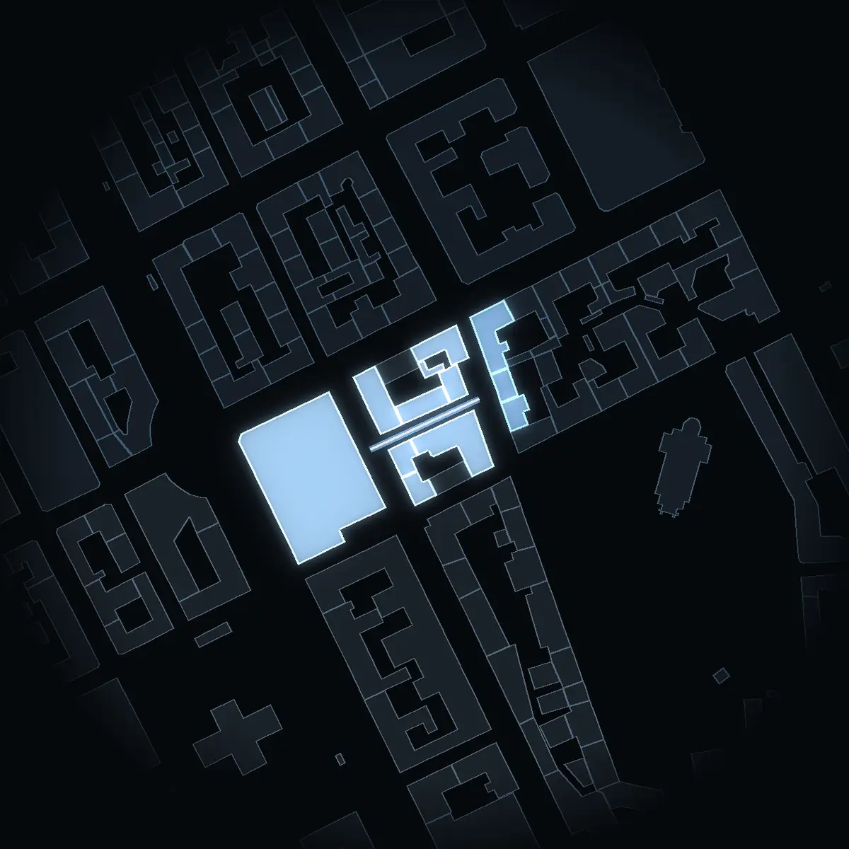
Every house on Rosengatan with an address, on the map – its buildings drawn at their real heights from the city's 3D model. Walk along the street with the slider, switch between the odd and the even side, or tap a house.
Skip the mapThe bars are the houses at their heights from the city's 3D model – the even side above the line, the odd side below. Tap one to see the house.
2 houses with an address · 2 in Stadsmuseet's inventories. Tap one for its own page.
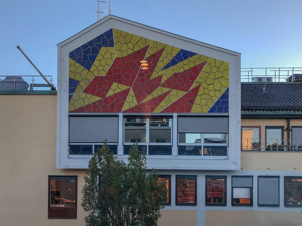
The houses of Rosengatan in photographs, each under a free licence, credited to its photographer.
The street set against Stockholm and the whole of Sweden. Each figure is for the finest area its publisher reports – the street's own statistical area, Norrmalm or the district of Norra innerstaden – and says which. Nothing is modelled.
Share of homes, 2025 · The street's areas
22 percentage points above Stockholm
Share of homes, hyresrätt, 2025 · The street's areas
14 percentage points below Stockholm
Sales in the 12 months to September 2026 · Vasastan/Norrmalm
44 % above Stockholm
July–September 2026 against 2025 · Vasastan/Norrmalm
3.0 percentage points above Stockholm
1 January 2026 · Norra innerstaden
12 % above Stockholm
Average years queued for the existing flats let in 2025 · Norra innerstaden
69 % above Stockholm
Per 1,000 residents, 2025 · Norra innerstaden
34 % above Stockholm
Per 1,000 residents, 2025 · Norra innerstaden
30 % below Stockholm
Share of residents, 2025 · The street's areas
3.3 percentage points above Stockholm
Share of households, 2025 · The street's areas
7.7 percentage points below Stockholm
Share of households, 2025 · The street's areas
5.5 percentage points above Stockholm
Share of residents aged 25–65, 2025 · The street's areas
8.0 percentage points above Stockholm
Löneinkomst per person 20+, SEK thousand a year, 2024 – the latest SCB publishes per area · The street's areas
27 % above Stockholm
Per person 20+, SEK thousand a year, 2024 – the latest SCB publishes per area · The street's areas
3.5 times Stockholm's
SEK thousand a month, people 20+, capital income not included – SCB's preliminary monthly figures, not published per area · Stockholm
Not published for the street's areas.
January–June 2026, as above · Stockholm
Not published for the street's areas.
In traffic, registered to residents, per 1,000 residents, 2025 · The street's areas
25 % below Stockholm
The street's areas: Statistics Sweden's DeSO 0180C4620, 1,578 residents – in SCB's areas Södra Adolf Fredrik. Incomes are means, so a few very large incomes pull them up; capital income includes gains on sales of shares and property. Sources: Statistics Sweden (October 2026), Svensk Mäklarstatistik, Bostadsförmedlingen, Brå.
Seven homes in ten here are bostadsrätter – you buy a share in the association that owns the building, and pay it a monthly fee. The rest are rented, through the city's queue or second hand.
Up 10.9 % in a year. Prices per m², July–September 2026:
Svensk Mäklarstatistik, bostadsrätter, updated 8 October 2026. Averages; the source publishes no medians. Source
The county's median bostadsrätt sold for 5.2 times as much in 2025 as in 2000 – SEK 3.5m against SEK 0.68m.
Median sale price of a bostadsrätt, SEK thousand – Stockholm county, the finest level Statistics Sweden publishes; not the street. SCB, BO0501C.
About 16,600 kr a month for 100 m² at the median. Stockholm as a whole: 1,772 kr per m².
Rent here runs 12 % above the city: 1,993 kr per m² a year in Norra innerstaden in 2026, against 1,772 kr for Stockholm and 1,483 kr for Sweden.
Median rent per m² a year. Statistics Sweden reported Norrmalm on its own until 2023; from 2024 it reports Norra innerstaden, the new district of Östermalm and Norrmalm – hence the dashed line. Hover or tap a point for the figure; on a keyboard, tab to the chart and use the arrow keys.
Bostadsförmedlingen i Stockholm, statistics for 2025. Source
Brå counts Norrmalm within Norra innerstaden, together with Vasastaden, Östermalm and Djurgården – 34 % more reported crime per resident than Stockholm in 2025. Safety is told for the district, never for the street.
Share of residents who feel unsafe, or stay in, when out alone late at night in their own area, 2026 – Stockholms stad's survey, which reports Norra innerstaden as a whole; it does not say which streets fall in its smaller areas.
Norra innerstaden, which takes in the city centre, ran 34 % above Stockholm in 2025.
Reported crimes per 1,000 residents. Brå reports Norra innerstaden from 2024, when the city joined the districts of Norrmalm and Östermalm; the years before are not counted for it.
Per 1,000 residents
31 % above Stockholm
18 % above Stockholm
30 % below Stockholm
87 % above Stockholm
18 % above Stockholm
69 % above Stockholm
27 % above Stockholm
Brå: reported crime is not all crime – not every crime comes to the police's attention. Local figures go by where the crime happened and are set against the people who live there. Our note: a district full of theatres, restaurants, shops and stations can therefore show a high rate against few residents. In 2025, 12 % of reports in the Stockholm police region had no recorded municipality. Sources: Brå, reported offences; Stockholms stad, Trygghetsmätning 2026 (source).
1,578 people live in the street's area. 40 % of them are over fifty (Stockholm: 35 %), 20 % of the households have children, and of those aged 25–65, 55 % hold a university degree of three years or more (Stockholm: 47 %).
20 % of the residents here are 65 or over – against 17 % across Stockholm; the street's areas have more people aged 20–49.
Share of residents in each age group, 2025. Statistics Sweden.
Mean net income in the street's areas was SEK 767k a year per person aged 20 and over in 2024, up from 626k in 2019 – Stockholm: 468k in 2024.
Walking times along the street network from the nearest point of Rosengatan, at 80 metres a minute.
Stations: SL and Trafiklab; the walk is measured along OpenStreetMap's paths and pavements, so it is never shorter than the straight line. Schools: Skolverket's school-unit register.
Streets next door: LuntmakargatanRådmansgatanSaltmätargatanHolländargatanJohannes PlanJohannesgatanAdolf Fredriks KyrkogataJutas Backe
The nearest care and everyday places from Rosengatan, nearest first, with the way there in Google Maps or Apple Maps. Emergency care is shown however far it is; everything else within 2 km.
In an emergency, call 112Medical advice day and night: 1177
Sankt Göransgatan 139 · 2.3 km
Open 24/7 · 08-587 010 00
Karolinska vägen 39, Solna · 2.1 km
Anna Steckséns gata 35, Solna · 2.0 km
Open 24/7 · 08-123 771 02
Tegnérgatan 23
102 m
69 m
330 m
507 m
895 m
Klarabergsviadukten 49 · 1.0 km
Distance in a straight line from the nearest point of the street; the walk is estimated at 1.3 times that, at 80 metres a minute. Source: © OpenStreetMap contributors (ODbL), emergency and urgent care and health centres checked against 1177, police stations against Polisen, October 2026.
Metro Mode's Stockholm guides from 2025 and 2026, read address by address. On the street and around the corner, with the guide each tip comes from.
Fish soup and lobster roll on the menu, the day's fish and oysters on the board – in our 2026 fish and seafood guide.
Fish and seafood in Stockholm – from oysters to fried cod, 2026Natural wine and Swedish vegetables in season, more than ten wines by the glass – in our 2026 bar guide and on the 2025 trendy wine bars list.
Wine and cocktail bars in Stockholm – 8 addresses for your next night out, 2026In 2 Metro Mode guidesSouth-East Asian flavours, with a vegetarian tasting menu in four servings – in our 2026 vegetarian guide and on the 2025 trendiest list.
Vegetarian and vegan in Stockholm – where the green gets the space, 2026In 2 Metro Mode guidesRavioli, risotto and pappardelle, and longer menus for the whole table – in our 2026 Italian guide.
Italian in Stockholm – pizza, pasta and trattorias to return to, 2026The general election of 13 September 2026, final result, in the voting district Rosengatan lies in. The figures are the whole district's, not just the street's.
The districtStockholms kommun
| Party | Stockholm | County | Sweden |
|---|---|---|---|
| Moderates | 19.1 % | 21.8 % | 19.9 % |
| Centre Party | 9.8 % | 8.6 % | 7.0 % |
| Liberals | 7.1 % | 6.8 % | 5.3 % |
| Christian Democrats | 3.9 % | 4.9 % | 6.2 % |
| Social Democrats | 26.3 % | 26.0 % | 28.0 % |
| Left Party | 13.0 % | 10.2 % | 8.4 % |
| Green Party | 11.1 % | 8.0 % | 6.1 % |
| Sweden Democrats | 8.4 % | 12.1 % | 17.5 % |
| Other parties | 1.2 % | 1.4 % | 1.6 % |
| Turnout | 85.8 % | 84.7 % | 84.9 % |
Share of valid votes in each district. The tick on each bar is Stockholms kommun. Change since 2022 in percentage points. Early votes that arrived late are counted in the municipality's collection district and are in no district's shares. The election is not part of the VERA PI Score. Source: Valmyndigheten, final result, published 7 October 2026. Valmyndigheten's data
Two cards for Rosengatan: the street in figures, and its VERA PI Score. Share one and the link arrives with that card as its picture; save it for Instagram. Every house on the street has its own card too.

Buildings and heights: building outlines © OpenStreetMap contributors, ODbL 1.0 (Geofabrik's Sweden extract, October 2026); heights (rounded), property designations and use derived from Stockholms stad's 3D model (SBK 3D-Byggnader LOD1; the catalogue states no licence).
The houses: Stadsmuseet i Stockholm, Byggnadsinventering City I (1976), City II (1976) and Industrimiljöer i Stockholm. Innerstaden (Stockholms stadsmuseum, industrimiljöinventering 1979), via Stockholmskällan – year built (building permit to final inspection), architect, client, master builder and facade, each checked three times against the scanned page and linked to that page. Facades and later changes are quoted in the inventory's Swedish.
People, homes, income, education, cars and rents: Statistics Sweden (SCB), CC BY 4.0 – DeSO tables for 2025 (population, households, tenure, education, cars) and 2024 (income, the latest per area), the preliminary monthly income statistics HE0110M for 2025–2026, rents by district (BO0406) and the county's bostadsrätt prices (BO0501C); October 2026.
Prices: Svensk Mäklarstatistik, bostadsrätter, updated 8 October 2026. Asking prices: the estate agencies’ own adverts, October 2026 – asking prices, not sales; no Hemnet, no Booli. Rental queue: Bostadsförmedlingen i Stockholm, 2025.
Crime and safety: Brottsförebyggande rådet (Brå), reported offences 2015–2025; Stockholms stad, Trygghetsmätning 2026, Norra innerstaden.
Getting around: SL and Trafiklab stops; walks along OpenStreetMap's network. Schools: Skolverket, school unit register. Parks: OpenStreetMap.
The VERA PI Score: VERA PI's own ranking of Stockholm stad's 4,346 streets, version 1 – not a price and not a valuation.
Photographs: Wikimedia Commons, each under the licence named in its caption.