Akutmottagning, Danderyds sjukhus
Entrévägen 4, Danderyd
Open 24/7 · 08-123 550 00
Places
På svenskaSamma sida på svenska Stockholms län26 municipalities on the map Stockholm stadEvery district ÖstermalmStreet by street StrandvägenHouse by house For saleHomes on the market nowOn Minervavägen
The street670 mClose byCare and everydayThe area around itSCB, DeSOGetting aroundStops, schools, parksSollentunaThe municipalityVERA PI
The companyvpios.com All markets
street
38 buildings stand along its 670 m in Sollentuna. The DeSO area it runs through has a mean net income of SEK 385k, and 59% of their dwellings are bostadsrätter. Häggvik (rail) is a 3-minute walk.
53.6VERA PI Scoreno. 103 of 662 in Sollentuna
The street as OpenStreetMap maps it, its area as SCB counts it.
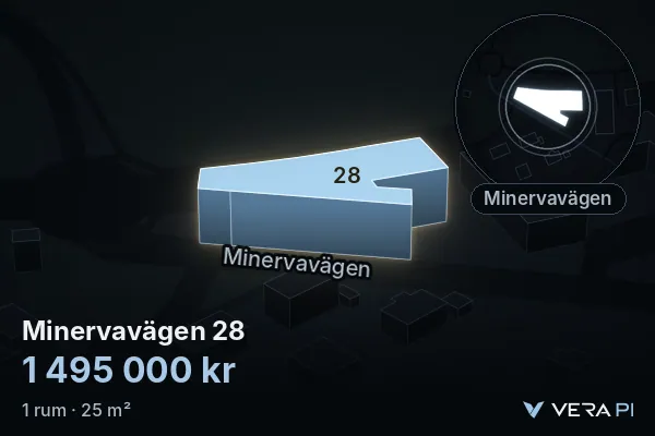
Shared home · for sale on Minervavägen
 Coming soon
SEK 1.5m59,800 SEK/m²
Co-op flat · 1 room · 25 m² · floor 2 of 5 · built 2017
Fee 2,175 SEK/month
Bjurfors · Agent's listing
Free for Metro Mode readers
Become a member and see everything about Minervavägen: every house, the prices, what’s for sale and the map. It takes 30 seconds.
VERA PI Score
Better placed than 54% of Stockholm stad's 4,346 streets – no. 103 of 662 in Sollentuna.
Each part is a rank among all of Stockholms stad's streets; the parts are weighted and the total ranked again – the same measure for every street, so any two can be compared and shared. It is VERA PI's own ranking, not a price and not a valuation. Streets outside Stockholm stad are placed in Stockholm stad's distribution; a street with no metro, commuter-rail or tram stop within a 6 km walk gets 0 for getting around.
Sources: © OpenStreetMap contributors, SL's stops, Skolverket, SCB (mean net income 2024 per DeSO) · VERA PI Score v1, calculated 21 Oct 2026, 14:52.
The street
Minervavägen is a residential street of about 670 m in Sollentuna. OpenStreetMap draws 38 buildings within 25 m of its line.
OpenStreetMap’s own tags – most Swedish buildings carry no use, so «not tagged» is common and says nothing about the building.
Addresses
The street's current addresses in VERA PI's databases, each with the property it belongs to – 23 properties. An address with its own building page on verapi.se is linked.
| Address | Postcode | Property |
|---|---|---|
| Minervavägen 2 A | 191 50 Sollentuna | Sollentuna Spaden 2 |
| Minervavägen 2 B | 191 50 Sollentuna | Sollentuna Spaden 2 |
| Minervavägen 2 C | 191 50 Sollentuna | Sollentuna Spaden 2 |
| Minervavägen 2 D | 191 50 Sollentuna | Sollentuna Spaden 2 |
| Minervavägen 2 E | 191 50 Sollentuna | Sollentuna Spaden 2 |
| Minervavägen 4 A | 191 50 Sollentuna | Sollentuna Spaden 2 |
| Minervavägen 4 B | 191 50 Sollentuna | Sollentuna Spaden 2 |
| Minervavägen 4 C | 191 50 Sollentuna | Sollentuna Spaden 2 |
| Minervavägen 5 A | 191 50 Sollentuna | Sollentuna Spiran 1 |
| Minervavägen 5 B | 191 50 Sollentuna | Sollentuna Spiran 1 |
| Minervavägen 5 C | 191 50 Sollentuna | Sollentuna Spiran 1 |
| Minervavägen 5 D | 191 50 Sollentuna | Sollentuna Spiran 1 |
| Minervavägen 5 E | 191 50 Sollentuna | Sollentuna Spiran 1 |
| Minervavägen 6 A | 191 50 Sollentuna | Sollentuna Spaden 2 |
| Minervavägen 6 B | 191 50 Sollentuna | Sollentuna Spaden 2 |
| Address | Postcode | Property |
|---|---|---|
| Minervavägen 6 C | 191 50 Sollentuna | Sollentuna Spaden 1 |
| Minervavägen 8 A | 191 50 Sollentuna | Sollentuna Spaden 1 |
| Minervavägen 8 B | 191 50 Sollentuna | Sollentuna Spaden 1 |
| Minervavägen 8 C | 191 50 Sollentuna | Sollentuna Spaden 2 |
| Minervavägen 8 D | 191 50 Sollentuna | Sollentuna Spaden 2 |
| Minervavägen 8 E | 191 50 Sollentuna | Sollentuna Spaden 1 |
| Minervavägen 9 | 191 50 Sollentuna | Sollentuna Spiran 35 |
| Minervavägen 10 A | 191 50 Sollentuna | Sollentuna Sådden 1 |
| Minervavägen 10 B | 191 50 Sollentuna | Sollentuna Sådden 1 |
| Minervavägen 11 A | 191 50 Sollentuna | Sollentuna Spiran 49 |
| Minervavägen 11 B | 191 50 Sollentuna | Sollentuna Spiran 50 |
| Minervavägen 11 C | 191 50 Sollentuna | Sollentuna Spiran 51 |
| Minervavägen 11 D | 191 50 Sollentuna | Sollentuna Spiran 52 |
| Minervavägen 11 E | 191 50 Sollentuna | Sollentuna Spiran 32 |
| Minervavägen 11 F | 191 50 Sollentuna | Sollentuna Spiran 46 |
| Minervavägen 11 G | 191 50 Sollentuna | Sollentuna Spiran 47 |
| Minervavägen 11 H | 191 50 Sollentuna | Sollentuna Spiran 48 |
| Minervavägen 13 | 191 50 Sollentuna | Sollentuna Spiran 29 |
| Minervavägen 16 | 191 50 Sollentuna | Sollentuna Staven 7 |
| Minervavägen 17 | 191 50 Sollentuna | Sollentuna Spiran 28 |
| Minervavägen 18 | 191 50 Sollentuna | Sollentuna Staven 6 |
| Minervavägen 19 | 191 50 Sollentuna | Sollentuna Spiran 14 |
| Minervavägen 20 | 191 50 Sollentuna | Sollentuna Staven 6 |
| Minervavägen 21 | 191 50 Sollentuna | Sollentuna Spiran 13 |
| Minervavägen 22 | 191 50 Sollentuna | Sollentuna Staven 6 |
| Minervavägen 23 | 191 50 Sollentuna | Sollentuna Spiran 8 |
| Minervavägen 24 | 191 50 Sollentuna | Sollentuna Staven 3 |
| Minervavägen 25 | 191 50 Sollentuna | Sollentuna Spiran 5 |
| Minervavägen 27 | 191 50 Sollentuna | Sollentuna Spiran 3 |
| Minervavägen 28 | 191 50 Sollentuna | Sollentuna Staven 3 |
Belägenhetsadress, Fastighetsindelning © Lantmäteriet, processed by VERA PI, CC BY 4.0. Read 29 Oct 2026.
The nearest care and everyday places from Minervavägen, nearest first, with the way there in Google Maps or Apple Maps. Emergency care is shown however far it is; everything else within 2 km.
In an emergency, call 112Medical advice day and night: 1177
Entrévägen 4, Danderyd
Open 24/7 · 08-123 550 00
Nytorpsvägen 10
Anna Steckséns gata 35, Solna
Open 24/7 · 08-123 771 02
Bagarbyvägen 61A · 982 m
Norra Malmvägen 82 · 533 m
by Stationsallén 2 · 1.0 km
Studievägen 2 · Convenience store · 131 m
Hammarbacken 4B · Post office · 620 m
Folkungavägen 29 · 139 m
709 m
by Häggviksvägen 18 · 148 m
Distance in a straight line from the nearest point of the street; the walk is estimated at 1.3 times that, at 80 metres a minute. Source: © OpenStreetMap contributors, emergency departments, urgent care and health centres from 1177 (Region Stockholm), police stations from Polisen, October 2026.
The named places on Minervavägen as OpenStreetMap maps them – shops, food and drink, culture, hotels and more – each with the way there.
A place is on the street when its address is on it, or – without an address – when it lies within 30 metres of the street and the street is the nearest; parks on every street they border. Shops inside a shopping centre are counted on the centre. Source: © OpenStreetMap contributors, data until 18 October 2026.
The area around it
The street runs through one of SCB’s DeSO areas – Häggvik-Klasro. Together they have 2,339 people (2025) with a mean net income of SEK 385k (2024), −16.2% against Sollentuna as a whole. These are the areas’ figures, not the street’s: SCB counts people by area, never by street.
Dwellings in the DeSO areas the street runs through, 1,299 in all.
People 2025, net income 2024 and dwellings by tenure by DeSO area: Source: Statistics Sweden, CC BY 4.0 – an area counts where at least a tenth of the street runs through it.
The general election of 13 September 2026, final result, in the 2 voting districts Minervavägen runs through, the largest share of the street first. The figures are each whole district's, not just the street's.
The districtSollentuna
| Party | Sollentuna | County | Sweden |
|---|---|---|---|
| Moderates | 24.1% | 21.8% | 19.9% |
| Centre Party | 10.4% | 8.6% | 7.0% |
| Liberals | 7.6% | 6.8% | 5.3% |
| Christian Democrats | 5.6% | 4.9% | 6.2% |
| Social Democrats | 26.3% | 26.0% | 28.0% |
| Left Party | 8.1% | 10.2% | 8.4% |
| Green Party | 6.2% | 8.0% | 6.1% |
| Sweden Democrats | 10.3% | 12.1% | 17.5% |
| Other parties | 1.4% | 1.4% | 1.6% |
| Turnout | 85.6% | 84.7% | 84.9% |
Share of valid votes in each district. The tick on each bar is the whole municipality's result (Sollentuna). Change since 2022 in percentage points, where Valmyndigheten says the district can be compared. Early votes that arrived late are counted in the municipality's collection district and are in no district's shares. The election is not part of the VERA PI Score. Source: Valmyndigheten, final result, published 7 October 2026. Valmyndigheten's data
Getting around
The nearest stop is Häggvik – 260 m on foot, about 3 minutes. 5 school units stand within 500 m of the street.
The walk is measured along OpenStreetMap’s streets and paths from the nearest point of the street, at 80 m a minute – never shorter than the straight line, which is shown beside it.
| Kind | Stop | Walk | Time | Straight line |
|---|---|---|---|---|
| Tunnelbana | Akalla | 4,320 m | 54 min | 3,540 m |
| Rail (pendeltåg, Roslagsbanan, Saltsjöbanan) | Häggvik | 260 m | 3 min | 220 m |
| Tram and light rail | none within 6 km | – | – | – |
Active units in Skolverket’s register, by distance from the street.
Named parks whose centre lies within 600 m, the largest first.
Stops, streets, paths and parks: © OpenStreetMap contributors. School units: Skolverket’s school-unit register (open data).
Prices – municipality level
SCB publishes sale prices by municipality and län – not by street. These are Sollentuna’s and Stockholms län’s, never Minervavägen’s.
Sollentuna’s prices since 1981 · Stockholms län’s bostadsrätter since 2000
Sales of småhus by municipality and of bostadsrätter by län: Source: Statistics Sweden, CC BY 4.0.
Streets nearby
Sources and licences
Every figure is official statistics from Statistics Sweden (SCB) under CC BY 4.0 – «Source: Statistics Sweden» – for the period stated beside it; boundaries from SCB’s DeSO 2025 and Stockholms stad’s Stadskarta (© Stockholms stad, Stadsbyggnadskontoret, CC BY); school units from Skolverket; buildings, stations and parks © OpenStreetMap contributors. Nothing here is a valuation. VERA PI has processed the figures (sums over DeSO areas, changes, ranks). Streets, buildings, stops and parks: © OpenStreetMap contributors – one street per name and municipality, its parts merged by VERA PI.